GeoField is helping the development community move from one-off geospatial analyses toward shared methods, reusable tools, and practical evidence systems for climate-smart agriculture and adaptation.
Launched with support from the Gates Foundation, GeoField has demonstrated how Earth observation, machine learning, and impact evaluation can help answer questions that are difficult to study through field data alone: where agricultural technologies are being adopted, how land and water systems are changing, and where investments are succeeding or stalling.
AidData continues to support the GeoField community of practice and is working with partners to expand this foundation into more adaptable, reusable modeling infrastructure. With additional support, GeoField can help funders and implementers move from episodic learning toward more continuous insight on climate adaptation, agricultural productivity, and resilience.


Journal special issue
We are pleased to share that a special issue focused on integrating Earth observation into impact studies on agriculture and climate change is now available in the Journal of Development Economics. The issue brings together cutting-edge research at the intersection of Earth observation and economic analysis, featuring contributions from members of the GeoField community of practice and collaborators working across agriculture, climate adaptation, and development in low and middle income country contexts.
Read the special issue ↗GeoField connects researchers, practitioners, funders, and implementing organizations working at the intersection of Earth observation, climate adaptation, agricultural development, and impact evaluation.
Launched with support from the Gates Foundation and led by AidData, DevGlobal Partners, and Mercy Corps, the initiative helps translate long-term observations of climate, land use, water, crops, and agricultural practices into program-ready evidence.
Use cases
Explore how GeoField partners are applying Earth observation, geospatial methods, and impact evaluation to real questions in climate adaptation and agricultural development.
Read more on the Observations blog
Thoughts from Mercy Corps
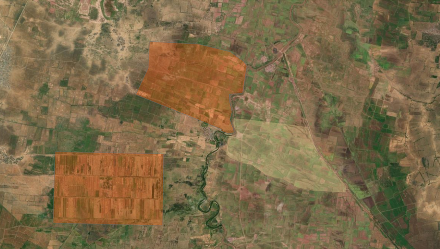
How synthetic controls helped test whether irrigation rehabilitation delivered results in Somalia
.jpeg.webp)
How a new database combines expert interpretation and deep learning to track land restoration over time
Evaluating Rainwater Harvesting for Lasting Resilience in Africa’s Drylands
Testing whether FMNR plus documented rights can scale reforestation and resilience
What a global assessment of spatial data readiness reveals about the path to geospatial impact evaluations
